Esri India Marketing | July 8, 2026 Cloud GIS vs On-Premise GIS: What Indian Organizations Need to Know Before Choosing
Esri India Marketing | July 3, 2026 How Indian Banks Are Using Location Intelligence to Expand Branch Networks and Reduce Risk
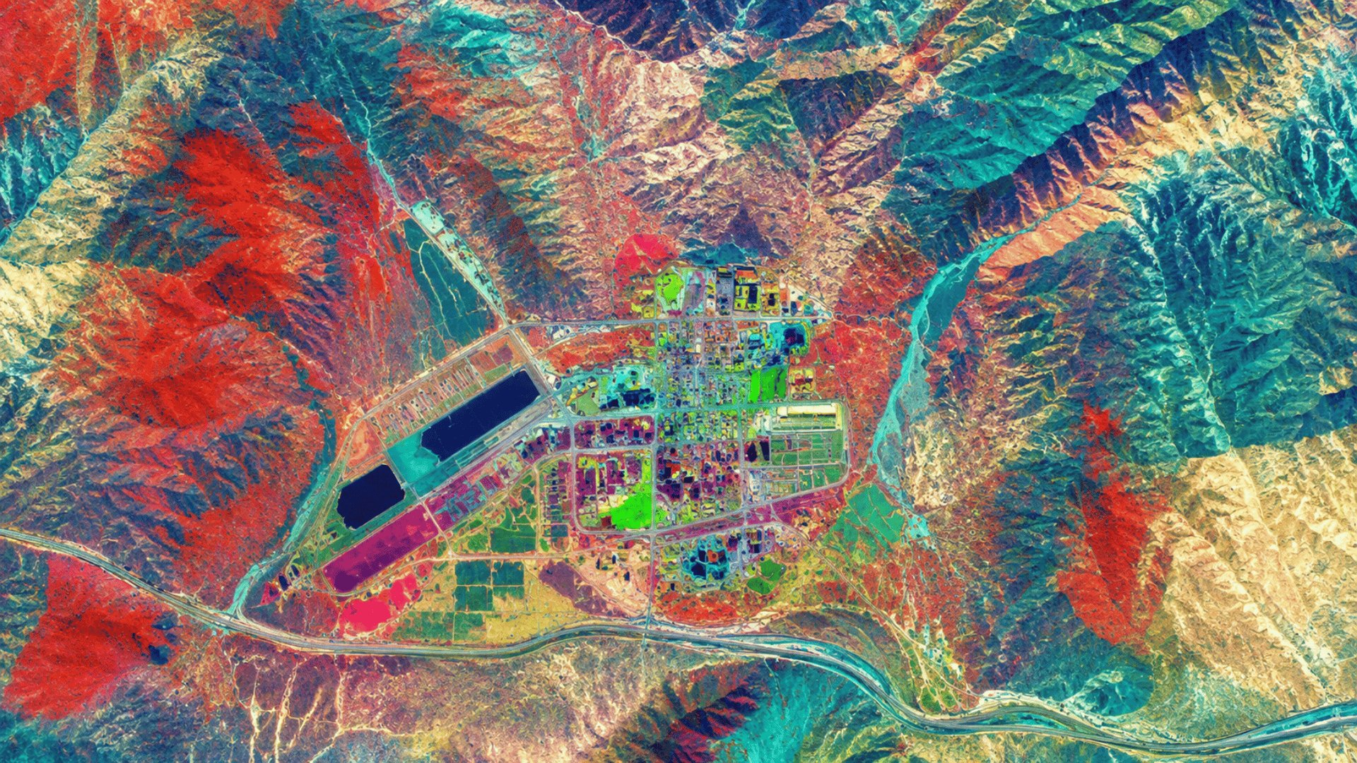
Esri India Marketing | July 2, 2026 How Hyperspectral Imagery Is Unlocking New Possibilities for Indian Mining and Geology
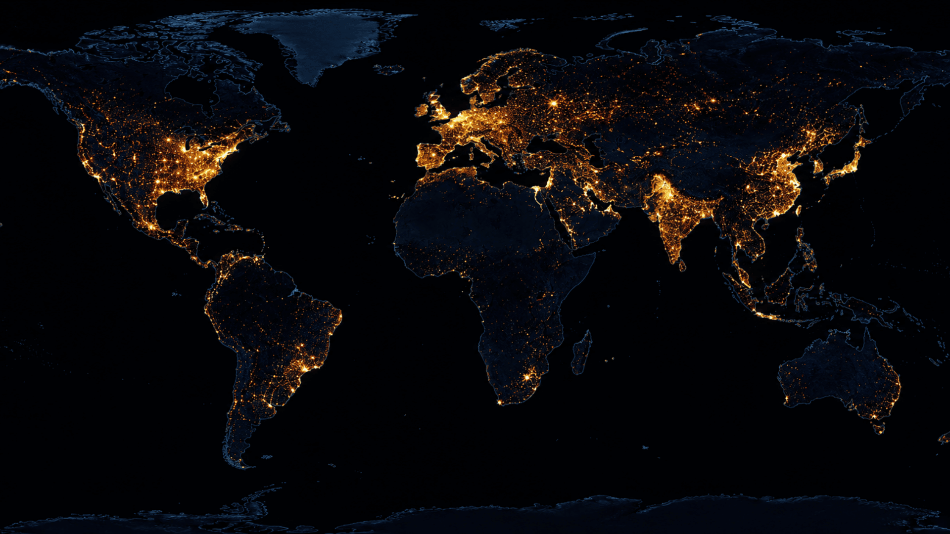
Esri India Marketing | July 1, 2026 How GIS Is Supporting India’s Net Zero Goals: Mapping Carbon Footprint and Emissions
Esri India Marketing | June 25, 2026 Heatwave Mapping and GIS: How India Is Building Early Warning Systems for Extreme Heat
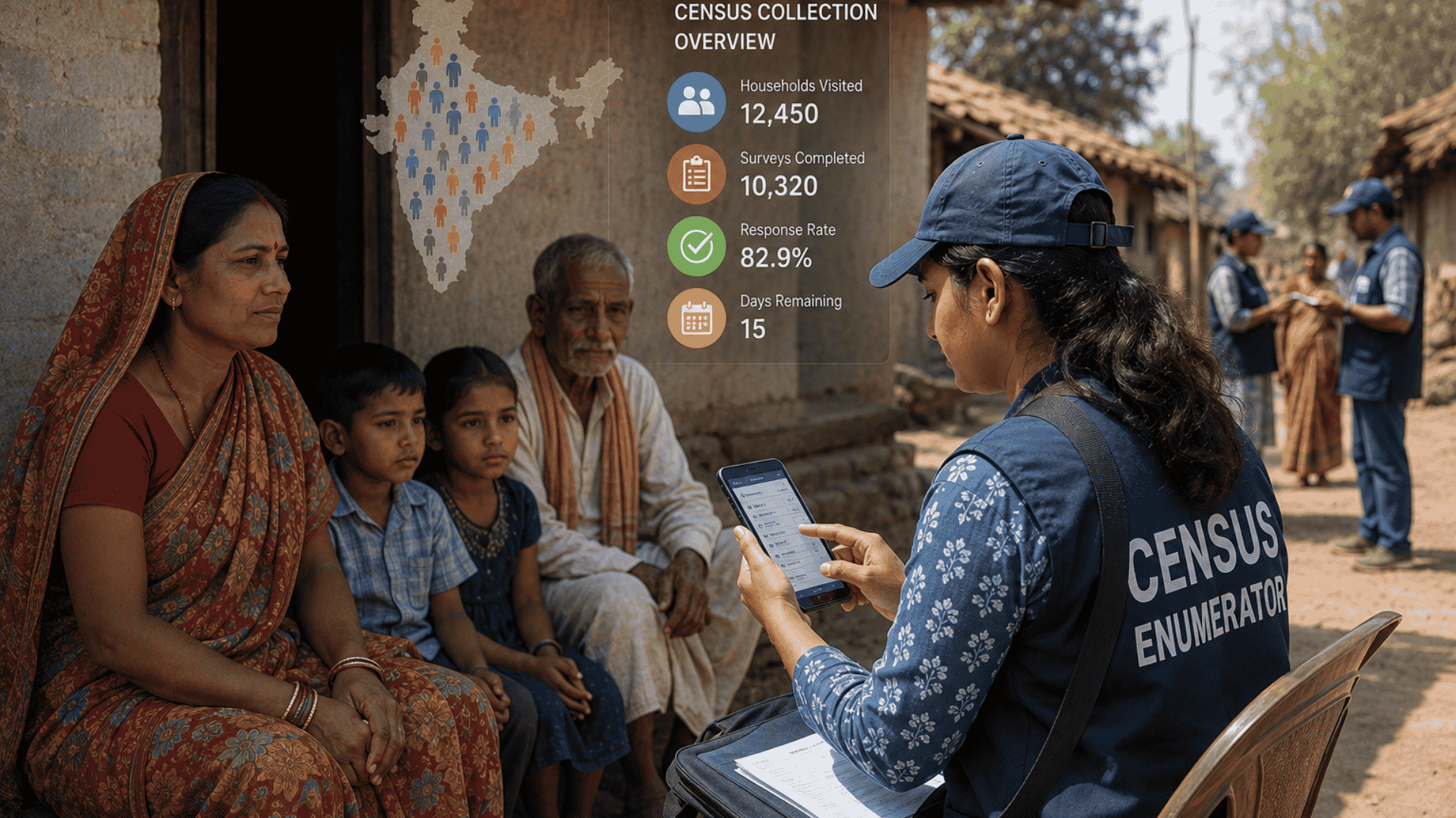
Esri India Marketing | June 24, 2026 How GIS Is Modernising India’s Census and Official Statistics Collection
Esri India Marketing | June 23, 2026 How GIS Is Powering India’s Election Constituency Delimitation and Voter Mapping
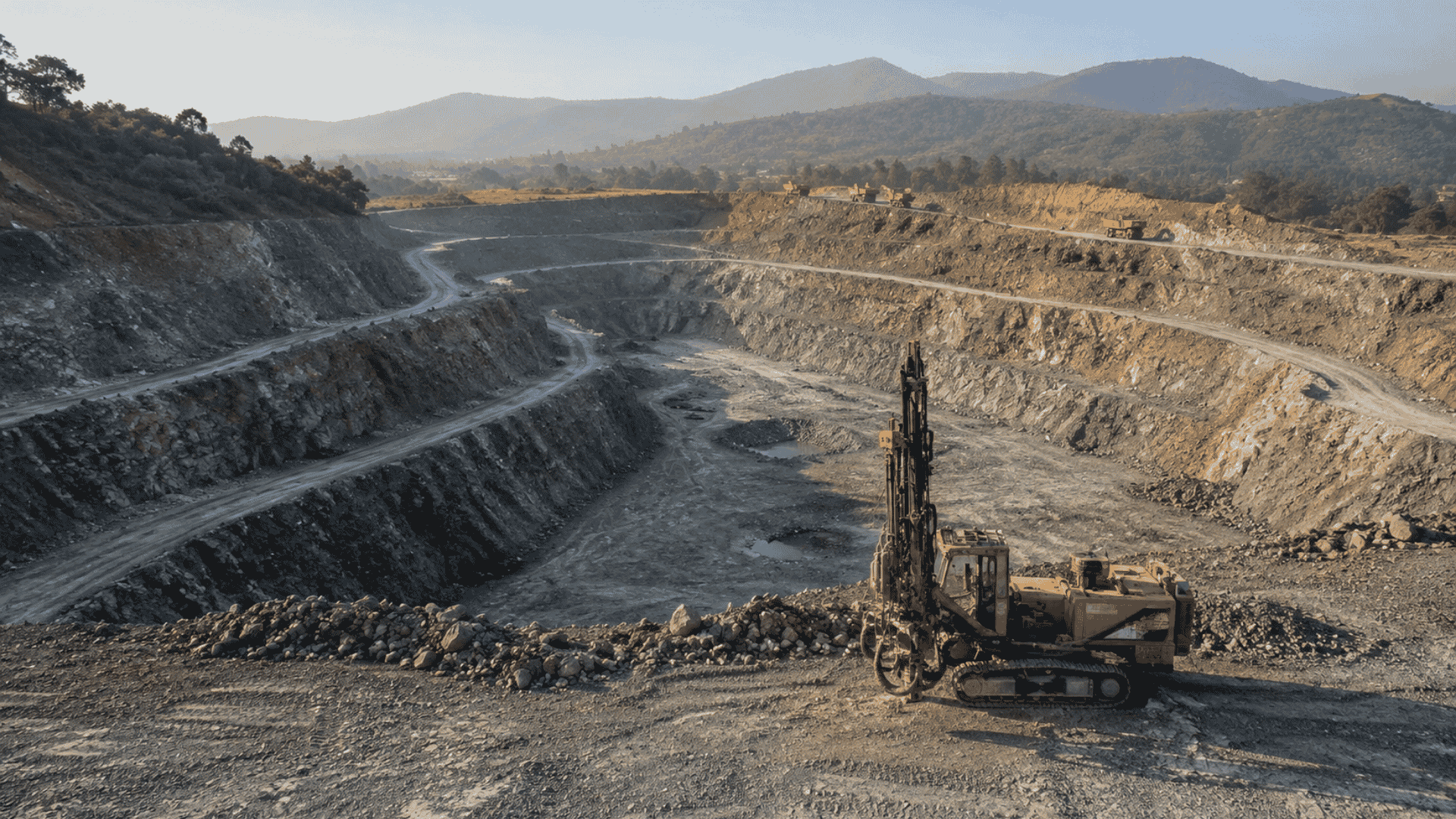
Esri India Marketing | June 18, 2026 How GIS Is Enabling Precision Mining in India: From Exploration to Rehabilitation
Esri India Marketing | June 17, 2026 GIS for Solid Waste Management: How Smart Cities in India Are Tracking Garbage Collection Routes
Esri India Marketing | June 16, 2026 GIS for Heritage and Tourism: How India Is Mapping Its Cultural Treasures for Smarter Planning
Esri India Marketing | June 12, 2026 Urban Heat Island Mapping with GIS: How Indian Cities Can Beat the Heat
Esri India Marketing | June 10, 2026 How GIS Is Strengthening India’s Coastal Zone Management and Blue Economy